
- Aboriginal History
- Cemeteries
- Hospitals
- Hotels
- Maps of the Goldfields
- Military
- Miners
- Miscellaneous
- People
- Places on the Goldfields
- Place Index A-Z
This website is dedicated to the memory of my two dear friends Sandy Duncan and Shyama Peebles who both passed away in 2012.
Kambalda/Redhill > Kambalda
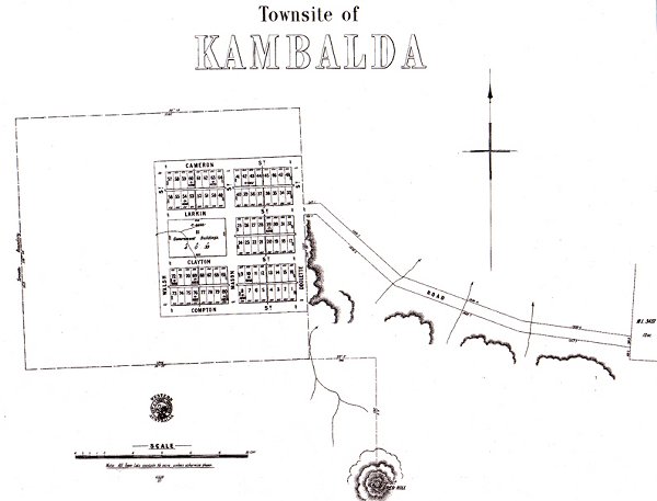
Kambalda
Western Australia
Latitude : 31 12 S Longitude : 121 40 E
The townsite of Kambalda is located in the eastern goldfields region, about 60 km south of Kalgoorlie. Gold was discovered in the area in 1897, and the government soon decided to declare a townsite here. The government surveyor, W Rowley nominated the name, as it sounded a pleasant name. It is an Aboriginal word, the meaning of which is unknown. The townsite was gazetted in December 1897.
There was little development at Kambalda, and the place remained a ghost town until the Western Mining Corporation found nickel nearby in the early 1970's. It then soon developed into a thriving company town.
"Kambalda - History of a mining town"Books of interest................
by J. J. Gresham
history of Red Hill & Kambalda
lots of pictures and indexed
Published by Western Mining Corp 1991
ISBN 0 646 03454 3
| Return to Kambalda/Redhill | Next Record Kambalda Cemetery Previously known as Redhill |